SCOR - Roguewood Fields
|
SCOR - Roguewood Fields |
|
|
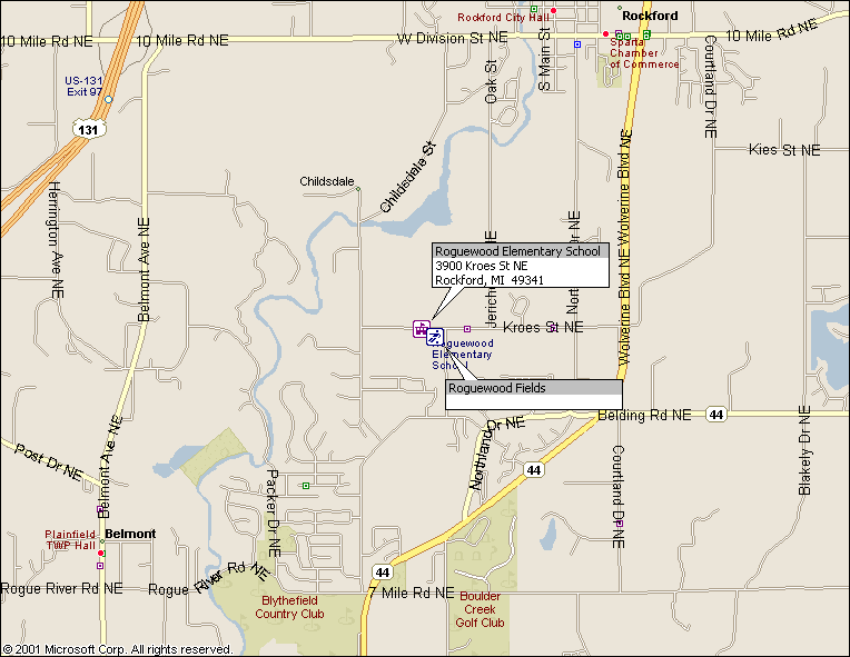
DRIVING DIRECTIONS
From the North and West:
US-131 to Exit 97 (10 Mile Rd)
East on 10 Mile Rd to Oak St (2.0 Miles)
South on Oak to Kroes Rd (1.6 Miles). Oak changes names to Jericho, which ends at Kroes
West (right) on Kroes to the fields (0.3 Miles)
From the South and East:
I-96 to Exit 38 (East Beltline)
North on the East Beltline (M-44) to Kroes Rd (8.4 Miles). The Beltline changes names to Northland Drive, then
Wolverine Blvd
West on Kroes to the fields (1.1 Miles)
The school is on the South side of the road, west of the high school. There are two fields, one U-10 sized.
Amenities
The nearest eateries are at Wolverine and 10 Mile.